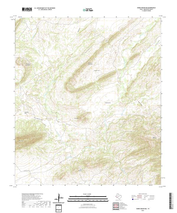
2022 Map of Horse Mountain
USGS Topo · Published 2022About this map
Chaney Ranch Rd provides the primary access point into this high-desert basin in Brewster County, where ephemeral drainages like Peña Blanca Cr and San Francisco Cr carve through a landscape of ridges and flats. The terrain is defined by the proximity of the Haymond Mountains and the Peña Blanca Mountains, leading to the prominent height of Horse Mtn. Historically significant water sources, often critical in this arid environment, appear as named features such as Dead Horse Hole and Dead Cow Hole. The map also captures several local landmarks with evocative names, including the Devils Backbone and Hells Half Acre, alongside the broader topography of Lightning Flat and Fighting Flat. These features suggest a history of ranching and land use shaped by the necessity of managing water and navigating the high country.
Find a feature on this map
20 named features on this map. Tap any name to fly to it.
Don’t see what you’re looking for? This feature index may not catch every label — zoom into the map to look around manually.
Map Details
Editions of this 2022 Horse Mountain Map
This is the sole edition of this map. No revisions or reprints were ever made.
Other maps of this area

1917 · Hood Spring
USGS Topo · 1:62,500

1918 · Bone Spring
USGS Topo · 1:125,000

1918 · Hood Spring
USGS Topo · 1:62,500

1918 · Dove Mountain
USGS Topo · 1:62,500

1920 · Longfellow
USGS Topo · 1:125,000

1920 · Marathon
USGS Topo · 1:62,500

1921 · Marathon
USGS Topo · 1:62,500

1931 · Hood Spring
USGS Topo · 1:62,500

1954 · Fort Stockton
USGS Topo · 1:250,000

1958 · Fort Stockton
USGS Topo · 1:250,000