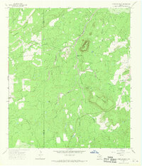
1967 Map of Horse Mountain
USGS Topo · Published 1970About this map
The Mason Co Llano Co line bisects this landscape of the Texas Hill Country, dominated by the prominent peaks of House Mountain and Putnam Mountain. This 1967 survey reveals a rural terrain defined by intricate drainage systems where waterways like Hickory Creek and Marschall Creek cut through the granite uplands. The presence of Putnam Cem near Hickory Creek provides a focal point for genealogical research in an area otherwise characterized by isolated ranching infrastructure.
Find a feature on this map
24 named features on this map. Tap any name to fly to it.
Don’t see what you’re looking for? This feature index may not catch every label — zoom into the map to look around manually.
Map Details
Editions of this 1967 Horse Mountain Map
This is the sole edition of this map. No revisions or reprints were ever made.
Other maps of this area

1917 · Hood Spring
USGS Topo · 1:62,500

1918 · Bone Spring
USGS Topo · 1:125,000

1918 · Hood Spring
USGS Topo · 1:62,500

1918 · Dove Mountain
USGS Topo · 1:62,500

1920 · Longfellow
USGS Topo · 1:125,000

1920 · Marathon
USGS Topo · 1:62,500

1921 · Marathon
USGS Topo · 1:62,500

1931 · Hood Spring
USGS Topo · 1:62,500

1954 · Fort Stockton
USGS Topo · 1:250,000

1958 · Fort Stockton
USGS Topo · 1:250,000