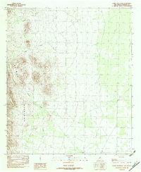
1982 Map of Horse Mountain
USGS Topo · Published 1982About this map
Animas Mountains dominate this high-desert landscape in Hidalgo County, defined by the stark verticality of the northern range. The map illustrates a drainage system focused around Cowboy Creek and Tullous Creek, which cut through the complex terrain below Horse Mountain. This provisional survey shows the area during the late 1970s and early 1980s, emphasizing natural landmarks and topographical elevation over human development. The name Fireplace appears on the eastern flats, providing a specific reference point for local history researchers or surveyors working in this specific section of the Chihuahuan Desert. Small landmarks such as Cedar Hill and the feature simply labeled Bluff serve as clear orientation points within the township and range grid system.
Find a feature on this map
10 named features on this map. Tap any name to fly to it.
Don’t see what you’re looking for? This feature index may not catch every label — zoom into the map to look around manually.
Map Details
Editions of this 1982 Horse Mountain Map
This is the sole edition of this map. No revisions or reprints were ever made.
Other maps of this area

1917 · Antelope Wells
USGS Topo · 1:62,500

1918 · Big Hatchet Peak
USGS Topo · 1:62,500

1918 · Dog Mountains
USGS Topo · 1:62,500

1918 · Walnut Wells
USGS Topo · 1:62,500

1919 · Antelope Wells
USGS Topo · 1:62,500

1923 · Walnut Wells
USGS Topo · 1:62,500

1955 · Douglas
USGS Topo · 1:250,000

1959 · Douglas
USGS Topo · 1:250,000

1961 · Douglas
USGS Topo · 1:250,000

1964 · Douglas
USGS Topo · 1:250,000