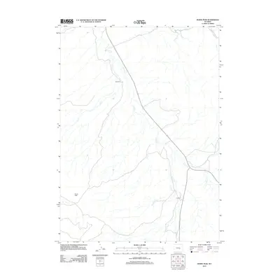
2012 Map of Horse Peak
USGS Topo · Published 2012About this map
Horse Peak overlooks a high-plains landscape defined by seasonal drainages and cattle ranching in this Wyoming survey. The map records the essential water sources that support the local economy, including Stinking Cr, Elk Cr, and Lawn Cr. These waterways dictate the placement of local homesteads such as Body Ranch and Kirk Ranch, which sit isolated amidst the drainage network. A significant piece of agricultural infrastructure, the Bates Hole Stock Trl, cuts across the northeastern corner of the sheet, providing a dedicated corridor for moving livestock. The map illustrates a contemporary livestock-driven economy where the availability of water at places like Lone Tree Cr and Hunt Cr remains the most critical factor for land use and settlement.
Find a feature on this map
9 named features on this map. Tap any name to fly to it.
Don’t see what you’re looking for? This feature index may not catch every label — zoom into the map to look around manually.
Map Details
Editions of this 2012 Horse Peak Map
This is the sole edition of this map. No revisions or reprints were ever made.
Other maps of this area

1950 · Alcova SE
USGS Topo · 1:24,000

1951 · Bear Mountain
USGS Topo · 1:24,000

1953 · Fourmile Point
USGS Topo · 1:24,000

1955 · Casper
USGS Topo · 1:250,000

1958 · Casper
USGS Topo · 1:250,000

1960 · Twin Buttes
USGS Topo · 1:24,000

1960 · Wild Irish Reservoir
USGS Topo · 1:24,000

1960 · Horse Peak
USGS Topo · 1:24,000

1960 · Sheep Creek
USGS Topo · 1:24,000

1960 · Mud Springs
USGS Topo · 1:24,000