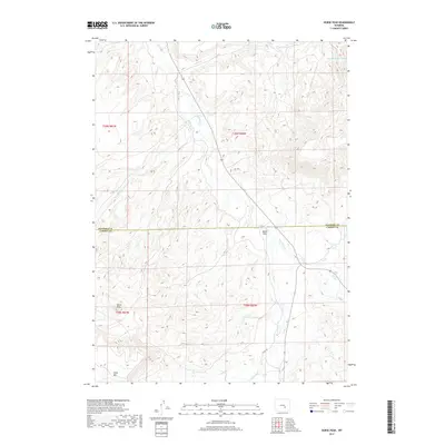
2017 Map of Horse Peak
USGS Topo · Published 2017About this map
Horse Peak rises as a prominent landmark in this high-altitude landscape along the border of Natrona and Carbon counties. The terrain is defined by complex drainage systems and significant landforms, most notably the broad depression of Bates Hole and the distinct elevation of Chalk Mtn. Water management in this arid environment is evident through the Chalk Hill Reservoirs situated in the northeast. The map documents an intricate network of seasonal and perennial waterways including Stinking Cr, Lawn Cr, and Lone Tree Cr, which carve through the townships of T28N and T29N. This 2017 survey illustrates the sparse human footprint in the region, where named landmarks and water sources serve as the primary navigational anchors across the open range.
Find a feature on this map
15 named features on this map. Tap any name to fly to it.
Don’t see what you’re looking for? This feature index may not catch every label — zoom into the map to look around manually.
Map Details
Editions of this 2017 Horse Peak Map
This is the sole edition of this map. No revisions or reprints were ever made.
Other maps of this area

1950 · Alcova SE
USGS Topo · 1:24,000

1951 · Bear Mountain
USGS Topo · 1:24,000

1953 · Fourmile Point
USGS Topo · 1:24,000

1955 · Casper
USGS Topo · 1:250,000

1958 · Casper
USGS Topo · 1:250,000

1960 · Twin Buttes
USGS Topo · 1:24,000

1960 · Wild Irish Reservoir
USGS Topo · 1:24,000

1960 · Horse Peak
USGS Topo · 1:24,000

1960 · Sheep Creek
USGS Topo · 1:24,000

1960 · Mud Springs
USGS Topo · 1:24,000