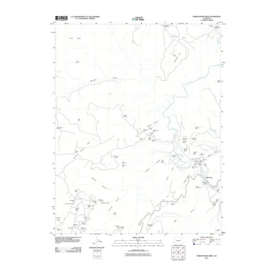
2011 Map of Horse Range Mesa
USGS Topo · Published 2011About this map
Horse Range Mesa and its surrounding canyons define a landscape heavily shaped by uranium and vanadium mining history in San Miguel County. The Dolores River cuts through the eastern portion of the map, passing beneath the Slick Rock Bridge near the small settlement of Slick Rock. This region is dense with named mining claims, showing an intensive pattern of resource extraction from Steamboat Hill down into the deep recesses of Cougar Canyon and Burro Canyon. Higher elevations to the west include Summit Point and the prominent Island Mesa. The concentration of small, individual mine sites like the Grubstake Mine, Katydid Mine, and Prospectors Fortune Mine reflects a legacy of prospectors and smaller operations that sought fortune in the Colorado Plateau's mineral-rich strata. Road networks like RD d1 and S 8 RD connect these remote sites across the mesas and draws.
Find a feature on this map
83 named features on this map. Tap any name to fly to it.
Don’t see what you’re looking for? This feature index may not catch every label — zoom into the map to look around manually.
Map Details
Editions of this 2011 Horse Range Mesa Map
This is the sole edition of this map. No revisions or reprints were ever made.
Other maps of this area

1885 · La Sal
USGS Topo · 1:250,000

1886 · Abajo
USGS Topo · 1:250,000

1892 · Abajo
USGS Topo · 1:250,000

1893 · Abajo
USGS Topo · 1:250,000

1916 · Paradox Valley
USGS Topo · 1:125,000

1922 · Paradox Valley
USGS Topo · 1:125,000

1948 · Bull Canyon
USGS Topo · 1:24,000

1948 · Horse Range Mesa
USGS Topo · 1:24,000

1948 · Hamm Canyon
USGS Topo · 1:24,000

1949 · Bull Canyon
USGS Topo · 1:24,000