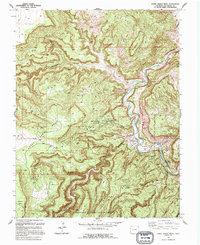
1994 Map of Horse Range Mesa
USGS Topo · Published 1994About this map
The Dolores River carves a deep, winding path through this corner of San Miguel County, creating a landscape defined by dramatic canyons and industrial utility. In the mid-1990s, the region was characterized by its rich mining history and strategic energy reserves, notably within the Department of Energy Uranium Reserve. The unincorporated settlement of Slick Rock serves as a small hub near the Slick Rock Bridge, while residential life is noted at a Mobile Home Park near Poverty Flat.
Find a feature on this map
40 named features on this map. Tap any name to fly to it.
Don’t see what you’re looking for? This feature index may not catch every label — zoom into the map to look around manually.
Map Details
Editions of this 1994 Horse Range Mesa Map
This is the sole edition of this map. No revisions or reprints were ever made.
Other maps of this area

1885 · La Sal
USGS Topo · 1:250,000

1886 · Abajo
USGS Topo · 1:250,000

1892 · Abajo
USGS Topo · 1:250,000

1893 · Abajo
USGS Topo · 1:250,000

1916 · Paradox Valley
USGS Topo · 1:125,000

1922 · Paradox Valley
USGS Topo · 1:125,000

1948 · Bull Canyon
USGS Topo · 1:24,000

1948 · Horse Range Mesa
USGS Topo · 1:24,000

1948 · Hamm Canyon
USGS Topo · 1:24,000

1949 · Bull Canyon
USGS Topo · 1:24,000