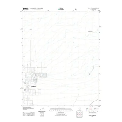
2012 Map of Horse Springs
USGS Topo · Published 2012About this map
Pahrump Valley serves as the central focus of this landscape, where residential expansion from Pahrump reaches toward the foothills of the Spring Mountains. The 2012 survey illustrates a burgeoning suburban grid with aviation-themed street names like Helicopter Ave, Monoplane Pl, and Kittyhawk Dr clustered near the Calvada Meadows Airport. This modern development contrasts with the traditional rural layout of the Simpkins Daniels Ranch and the Ray Vanhorn Farm. The eastern edge of the map transitions into the high-relief terrain of the mountains, where water sources like Santa Cruz Spring and Horse Springs are critical landmarks. The presence of Wood Canyon in the north further highlights the dramatic change from the flat valley floor to the desert uplands.
Find a feature on this map
48 named features on this map. Tap any name to fly to it.
Don’t see what you’re looking for? This feature index may not catch every label — zoom into the map to look around manually.
Map Details
Editions of this 2012 Horse Springs Map
This is the sole edition of this map. No revisions or reprints were ever made.
Other maps of this area

1907 · Las Vegas
USGS Topo · 1:250,000

1908 · Furnace Creek
USGS Topo · 1:250,000

1908 · Las Vegas
USGS Topo · 1:250,000

1910 · Furnace Creek
USGS Topo · 1:250,000

1948 · Death Valley
USGS Topo · 1:250,000

1954 · Las Vegas
USGS Topo · 1:250,000

1954 · Death Valley
USGS Topo · 1:250,000

1956 · Death Valley
USGS Topo · 1:250,000

1957 · Las Vegas
USGS Topo · 1:250,000

1957 · Death Valley
USGS Topo · 1:250,000