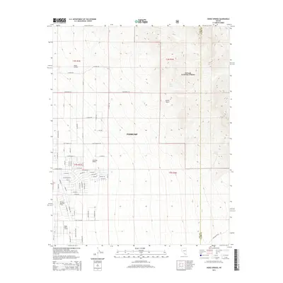
2014 Map of Horse Springs
USGS Topo · Published 2014About this map
Pahrump sits at the intersection of desert aviation and high-altitude forest in this 2014 survey. The topography shifts from the level expanses of the Pahrump Valley and the Mojave Desert into the steep terrain of the Toiyabe National Forest, where water sources like Santa Cruz Spring and Horse Springs are critical landmarks. The map documents a residential grid expanding into the arid landscape, with streets such as E Zorro Ln and Roadrunner Rd pushing toward the mountain foothills. This modern survey reflects the significant local aviation presence, anchoring the southern portion of the sheet with both Calvada Meadows Airport and Valley View Airport. To the north, the terrain rises sharply toward Wood Canyon, marking the transition from settlement to wilderness near the boundary of Nye and Clark counties.
Find a feature on this map
66 named features on this map. Tap any name to fly to it.
Don’t see what you’re looking for? This feature index may not catch every label — zoom into the map to look around manually.
Map Details
Editions of this 2014 Horse Springs Map
This is the sole edition of this map. No revisions or reprints were ever made.
Other maps of this area

1907 · Las Vegas
USGS Topo · 1:250,000

1908 · Furnace Creek
USGS Topo · 1:250,000

1908 · Las Vegas
USGS Topo · 1:250,000

1910 · Furnace Creek
USGS Topo · 1:250,000

1948 · Death Valley
USGS Topo · 1:250,000

1954 · Las Vegas
USGS Topo · 1:250,000

1954 · Death Valley
USGS Topo · 1:250,000

1956 · Death Valley
USGS Topo · 1:250,000

1957 · Las Vegas
USGS Topo · 1:250,000

1957 · Death Valley
USGS Topo · 1:250,000