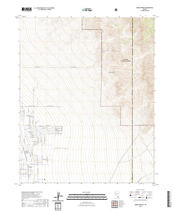
2021 Map of Horse Springs
USGS Topo · Published 2021About this map
The Spring Mountains rise sharply above the Pahrump Valley in this corner of the Mojave Desert, where the boundary between Nye and Clark Counties tracks north toward the Toiyabe National Forest. The map documents a distinct transition from the wild terrain of Horse Springs and Santa Cruz Spring to the emerging residential grid systems in the southwest. A high density of local street names like Rockinghorse Dr, Pony Dr, and Harris Farm RD suggests significant modern development encroaching on the desert floor. Aviation is central to the area's infrastructure, evidenced by both the Calvada Meadows Airport and the Valley View Airport, which serve this growing community on the edge of the mountains.
Find a feature on this map
57 named features on this map. Tap any name to fly to it.
Don’t see what you’re looking for? This feature index may not catch every label — zoom into the map to look around manually.
Map Details
Editions of this 2021 Horse Springs Map
This is the sole edition of this map. No revisions or reprints were ever made.
Other maps of this area

1907 · Las Vegas
USGS Topo · 1:250,000

1908 · Furnace Creek
USGS Topo · 1:250,000

1908 · Las Vegas
USGS Topo · 1:250,000

1910 · Furnace Creek
USGS Topo · 1:250,000

1948 · Death Valley
USGS Topo · 1:250,000

1954 · Las Vegas
USGS Topo · 1:250,000

1954 · Death Valley
USGS Topo · 1:250,000

1956 · Death Valley
USGS Topo · 1:250,000

1957 · Las Vegas
USGS Topo · 1:250,000

1957 · Death Valley
USGS Topo · 1:250,000