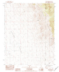
1984 Map of Horse Springs
USGS Topo · Published 1984About this map
The Spring Mountains dominate the eastern reaches of this mid-1980s topographic record, their slopes descending sharply into the wide expanse of the Pahrump Valley. This map captures a transition point in the high desert landscape along the border of Clark and Nye Counties. The availability of water in an otherwise arid environment is clearly marked by the presence of isolated water sources such as Santa Cruz Spring and the namesake Horse Springs, which likely served as vital landmarks for early travelers and ranchers in the region.
Find a feature on this map
6 named features on this map. Tap any name to fly to it.
Don’t see what you’re looking for? This feature index may not catch every label — zoom into the map to look around manually.
Map Details
Editions of this 1984 Horse Springs Map
This is the sole edition of this map. No revisions or reprints were ever made.
Other maps of this area

1907 · Las Vegas
USGS Topo · 1:250,000

1908 · Furnace Creek
USGS Topo · 1:250,000

1908 · Las Vegas
USGS Topo · 1:250,000

1910 · Furnace Creek
USGS Topo · 1:250,000

1948 · Death Valley
USGS Topo · 1:250,000

1954 · Las Vegas
USGS Topo · 1:250,000

1954 · Death Valley
USGS Topo · 1:250,000

1956 · Death Valley
USGS Topo · 1:250,000

1957 · Las Vegas
USGS Topo · 1:250,000

1957 · Death Valley
USGS Topo · 1:250,000