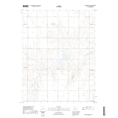
2018 Map of Horse Thief Canyon
USGS Topo · Published 2018About this map
Horse Thief Canyon and the winding course of Buckner Creek define this agricultural landscape in central Kansas. The terrain is structured by a rigorous grid of section-line roads, including H Rd, L Rd, and O Rd, reflecting the enduring Public Land Survey System. The map documents the intricate hydrology of the High Plains, where drainage channels like Spring Cr carve through the plateau. A significant reservoir formed by a dam on Buckner Cr serves as a central landmark amidst the surrounding farm and ranch land. This 2018 survey provides an essential record of the modern rural infrastructure and water management systems in Hodgeman County, illustrating how the natural canyon geography is integrated with the geometric requirements of local transport and commerce.
Find a feature on this map
24 named features on this map. Tap any name to fly to it.
Don’t see what you’re looking for? This feature index may not catch every label — zoom into the map to look around manually.
Map Details
Editions of this 2018 Horse Thief Canyon Map
This is the sole edition of this map. No revisions or reprints were ever made.
Other maps of this area

1892 · Ness
USGS Topo · 1:125,000

1892 · Dodge
USGS Topo · 1:125,000

1892 · Spearville
USGS Topo · 1:125,000

1894 · Spearville
USGS Topo · 1:125,000

1894 · Ness
USGS Topo · 1:125,000

1955 · Great Bend
USGS Topo · 1:250,000

1955 · Pratt
USGS Topo · 1:250,000

1955 · Dodge City
USGS Topo · 1:250,000

1955 · Scott City
USGS Topo · 1:250,000

1957 · Great Bend
USGS Topo · 1:250,000