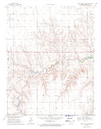
1970 Map of Horse Thief Canyon
USGS Topo · Published 1971About this map
Horse Thief Canyon cuts a distinct path through the High Plains landscape of Hodgeman County, Kansas, as recorded by the USGS in 1970. This topography is defined by the drainage systems of Buckner Creek, where the land transitions from high flatlands into dissected draws and canyons. The township structure is clearly marked by the boundaries of North Roscoe, Hallet, Benton, and South Roscoe, showing the political and agricultural divisions of the era. Evidence of local industry and geology appears in several locations, including a Caliche Pit and a Sandpit, as well as a solitary Drill Hole that suggests mineral exploration. Modern infrastructure is represented by the path of Highway 156, which serves as a primary east-west artery through this prairie terrain.
Find a feature on this map
11 named features on this map. Tap any name to fly to it.
Don’t see what you’re looking for? This feature index may not catch every label — zoom into the map to look around manually.
Map Details
Editions of this 1970 Horse Thief Canyon Map
This is the sole edition of this map. No revisions or reprints were ever made.
Other maps of this area

1892 · Ness
USGS Topo · 1:125,000

1892 · Dodge
USGS Topo · 1:125,000

1892 · Spearville
USGS Topo · 1:125,000

1894 · Spearville
USGS Topo · 1:125,000

1894 · Ness
USGS Topo · 1:125,000

1955 · Great Bend
USGS Topo · 1:250,000

1955 · Pratt
USGS Topo · 1:250,000

1955 · Dodge City
USGS Topo · 1:250,000

1955 · Scott City
USGS Topo · 1:250,000

1957 · Great Bend
USGS Topo · 1:250,000