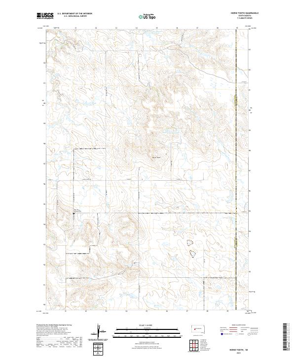
2021 Map of Horse Tooth
USGS Topo · Published 2021About this map
Saint Paul's Lutheran Cem sits as a solitary point of local heritage in this section of Pennington County, marking the landscape near Pedro Rd. The terrain is defined by the high point of Horse Tooth and a complex network of intermittent drainages including Deep Cr and the N Fork Bad River. This part of South Dakota demonstrates a persistent reliance on water management in a semi-arid environment, evidenced by substantial infrastructure like the Kirk Cordes Number 10 Reservoir and the Willuweit Dam Number 10 Reservoir. The map illustrates a strictly rectilinear road network, where routes like Big Foote Rd and Quinn-Pedro Rd serve the surrounding rangeland. The boundary between Pennington Co and Haakon Co runs along the eastern edge, showing the jurisdictional divisions that define this prairie landscape.
Find a feature on this map
21 named features on this map. Tap any name to fly to it.
Don’t see what you’re looking for? This feature index may not catch every label — zoom into the map to look around manually.
Map Details
Editions of this 2021 Horse Tooth Map
This is the sole edition of this map. No revisions or reprints were ever made.
Other maps of this area

1953 · Rapid City
USGS Topo · 1:250,000

1954 · Pierre
USGS Topo · 1:250,000

1955 · Creighton
USGS Topo · 1:24,000

1955 · Pedro SE
USGS Topo · 1:24,000

1957 · Rapid City
USGS Topo · 1:250,000

1958 · Pierre
USGS Topo · 1:250,000

1983 · Post Ranch
USGS Topo · 1:24,000

1983 · Philip
USGS Topo · 1:100,000
1983 · Grindstone
USGS Topo · 1:24,000
1983 · Horse Tooth
USGS Topo · 1:24,000