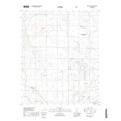
2018 Map of Horse Trap Mesa
USGS Topo · Published 2018About this map
Horse Trap Mesa rises above a high-desert landscape defined by vital water management and the sprawling boundaries of the Kaibab National Forest on the border of Coconino and Yavapai Counties. This 2018 survey reveals a modern rural grid emerging south of the forest, where residential roads like Valley View Blvd and Coconino Blvd contrast with the primitive tracks of the northern cattle country. The landscape is dotted with named tanks such as Pitts Homestead Tank, Santa Fe Tank, and Potts Tank, reflecting a long history of ranching infrastructure built to capture seasonal runoff from drainages like Eightmile Cr and Partridge Cr. These features indicate how modern settlement patterns in northern Arizona have both followed and expanded upon the older water-dependent ranching boundaries that once dominated this high plateau.
Find a feature on this map
71 named features on this map. Tap any name to fly to it.
Don’t see what you’re looking for? This feature index may not catch every label — zoom into the map to look around manually.
Map Details
Editions of this 2018 Horse Trap Mesa Map
This is the sole edition of this map. No revisions or reprints were ever made.
Other maps of this area

1886 · Chino
USGS Topo · 1:250,000

1891 · Chino
USGS Topo · 1:250,000

1922 · Williams
USGS Topo · 1:125,000

1947 · Ash Fork
USGS Topo · 1:62,500

1947 · Picacho Butte
USGS Topo · 1:62,500

1948 · Ash Fork
USGS Topo · 1:63,360

1948 · Williams
USGS Topo · 1:250,000

1948 · Picacho Butte
USGS Topo · 1:63,360

1949 · Ash Fork
USGS Topo · 1:62,500

1950 · Picacho Butte
USGS Topo · 1:62,500