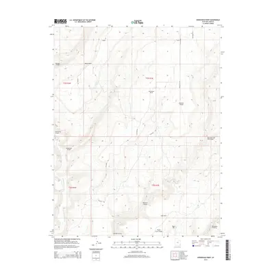
2014 Map of Horsehead Point
USGS Topo · Published 2014About this map
Horsehead Point and Pearson Point define the high terrain of this San Juan County landscape, where deep erosional features cut through the plateau. The map details a complex network of drainages including Bigwater Canyon and the winding Montezuma Canyon, which is fed by Montezuma Cr. These geological formations dictated the placement of early infrastructure, seen in the winding path of Pearson Rd and S Eastland Rd. Evidence of local ranching or agricultural history is grounded in names like Pickett Corral Canyon and the open expanse of Cedar Park. To the southeast, the terrain transitions into the distinct Coal Bed Canyon system and the prominent Table Top landmark, providing a detailed view of the remote Utah backcountry before more recent developments.
Find a feature on this map
24 named features on this map. Tap any name to fly to it.
Don’t see what you’re looking for? This feature index may not catch every label — zoom into the map to look around manually.
Map Details
Editions of this 2014 Horsehead Point Map
This is the sole edition of this map. No revisions or reprints were ever made.
Other maps of this area

1886 · Abajo
USGS Topo · 1:250,000

1892 · Abajo
USGS Topo · 1:250,000

1893 · Abajo
USGS Topo · 1:250,000

1955 · Verdure 4 NW
USGS Topo · 1:24,000

1955 · Verdure 2 SE
USGS Topo · 1:24,000

1955 · Verdure 3 SE
USGS Topo · 1:24,000

1955 · Verdure 1 SW
USGS Topo · 1:24,000

1955 · Verdure 4 SW
USGS Topo · 1:24,000

1955 · Verdure 3 NE
USGS Topo · 1:24,000

1956 · Cortez
USGS Topo · 1:250,000