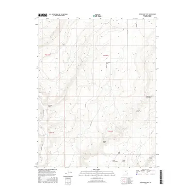
2017 Map of Horsehead Point
USGS Topo · Published 2017About this map
Horsehead Point and Pearson Point define the high terrain of this San Juan County landscape, overlooking a complex system of drainages and mesas. The geography is dominated by the deep incisions of Montezuma Canyon, where Montezuma Cr flows southward, and the branching reaches of Coal Bed Canyon and Bigwater Canyon to the east. This 2017 survey details the remote cattle-country infrastructure of the region, including named locations such as Cedar Park and Table Top. While the area is largely defined by its natural topography, the map records the network of rural routes like Cactus Park Rd and Montezuma Creek Rd that navigate the varied elevations between the canyon floors and the lookout points of the southern Colorado Plateau.
Find a feature on this map
24 named features on this map. Tap any name to fly to it.
Don’t see what you’re looking for? This feature index may not catch every label — zoom into the map to look around manually.
Map Details
Editions of this 2017 Horsehead Point Map
This is the sole edition of this map. No revisions or reprints were ever made.
Other maps of this area

1886 · Abajo
USGS Topo · 1:250,000

1892 · Abajo
USGS Topo · 1:250,000

1893 · Abajo
USGS Topo · 1:250,000

1955 · Verdure 4 NW
USGS Topo · 1:24,000

1955 · Verdure 2 SE
USGS Topo · 1:24,000

1955 · Verdure 3 SE
USGS Topo · 1:24,000

1955 · Verdure 1 SW
USGS Topo · 1:24,000

1955 · Verdure 4 SW
USGS Topo · 1:24,000

1955 · Verdure 3 NE
USGS Topo · 1:24,000

1956 · Cortez
USGS Topo · 1:250,000