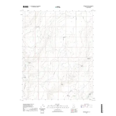
2020 Map of Horsehead Point
USGS Topo · Published 2020About this map
Montezuma Canyon defines the Western portion of this San Juan County landscape, where the perennial waters of Montezuma Cr have carved deeply through the plateau. High points like Horsehead Point and Pearson Point provide natural overlooks above the winding drainage networks of Horsehead Canyon and Bigwater Canyon. The map reveals a high-desert environment utilized for ranching and access, indicated by the network of corridors like Cactus Park Rd and the presence of Pickett Corral Canyon. In the southern reaches, more distinct formations emerge at Table Top and within Monument Canyon, where Monument Cr marks the terrain. The eastern edge is dominated by the branching systems of Coal Bed Canyon and the East Fork Coal Bed Canyon, showing the complex erosion patterns characteristic of this part of the Colorado Plateau.
Find a feature on this map
21 named features on this map. Tap any name to fly to it.
Don’t see what you’re looking for? This feature index may not catch every label — zoom into the map to look around manually.
Map Details
Editions of this 2020 Horsehead Point Map
This is the sole edition of this map. No revisions or reprints were ever made.
Other maps of this area

1886 · Abajo
USGS Topo · 1:250,000

1892 · Abajo
USGS Topo · 1:250,000

1893 · Abajo
USGS Topo · 1:250,000

1955 · Verdure 4 NW
USGS Topo · 1:24,000

1955 · Verdure 2 SE
USGS Topo · 1:24,000

1955 · Verdure 3 SE
USGS Topo · 1:24,000

1955 · Verdure 1 SW
USGS Topo · 1:24,000

1955 · Verdure 4 SW
USGS Topo · 1:24,000

1955 · Verdure 3 NE
USGS Topo · 1:24,000

1956 · Cortez
USGS Topo · 1:250,000