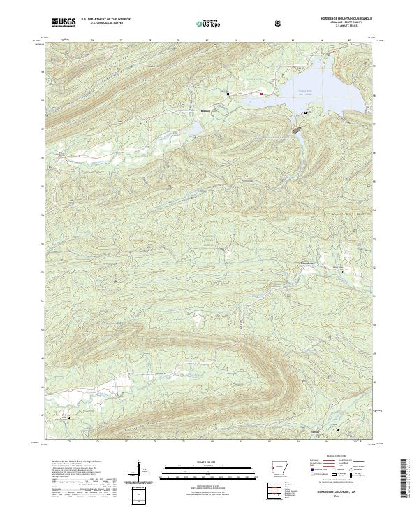
2024 Map of Horseshoe Mountain
USGS Topo · Published 2024About this map
Quachita National Forest blankets the rugged interior of Scott County, where the southern reaches of the Ozark-Ouachita region are defined by east-west ridges. Significant terrain features include Walker Mtn and Grassy Ridge in the north, while the southern border is anchored by Horseshoe Mountain. This drainage network is dominated by the Black Fork and Denton Creek, which cut through the ridges toward the Poteau River Site 13 Lake.
Find a feature on this map
50 named features on this map. Tap any name to fly to it.
Don’t see what you’re looking for? This feature index may not catch every label — zoom into the map to look around manually.
Map Details
Editions of this 2024 Horseshoe Mountain Map
This is the sole edition of this map. No revisions or reprints were ever made.
Other maps of this area

1879 · Poteau Mountain
USGS Topo · 1:62,500

1887 · Poteau Mountain #1
USGS Topo · 1:62,500

1887 · Poteau Mountain #2
USGS Topo · 1:62,500

1890 · Poteau Mountain
USGS Topo · 1:125,000

1899 · Poteau Mountain
USGS Topo · 1:125,000

1939 · Waldron
USGS Topo · 1:62,500

1940 · Waldron
USGS Topo · 1:62,500

1941 · Waldron
USGS Topo · 1:62,500

1949 · Waldron
USGS Topo · 1:62,500

1950 · Mcalester
USGS Topo · 1:250,000