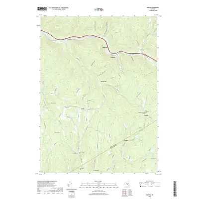
2019 Map of Horton
USGS Topo · Published 2019About this map
The Beaver Kill river serves as the central artery for this Catskill mountain region, flowing through the hamlets of Peakville, Elk Brook, Chiloway, and Horton. The landscape is defined by deep hollows and high ridges, where small valley settlements like Rock Valley and Acidalia persist along the winding creeks. Local history is preserved in small burial grounds including Gould Cem and Rickard Cem, while architectural landmarks like the Campbell Covered Bridge and Lower Shavertown Bridge span the local waterways. The map illustrates a rural network of county roads and mountain lanes, such as Co Rd 17 and Peakville Rd, that follow the natural contours of the land. The presence of features like Pine Swamp and Basket Pond suggests the varied topography that has shaped the growth of these mountain communities from the Delaware-Sullivan county line through the heart of the Horton quadrangle.
Find a feature on this map
101 named features on this map. Tap any name to fly to it.
Don’t see what you’re looking for? This feature index may not catch every label — zoom into the map to look around manually.
Map Details
Editions of this 2019 Horton Map
This is the sole edition of this map. No revisions or reprints were ever made.
Other maps of this area

1920 · Long Eddy
USGS Topo · 1:62,500

1921 · Long Eddy
USGS Topo · 1:48,000

1921 · Livingston Manor
USGS Topo · 1:62,500

1922 · Andes
USGS Topo · 1:62,500

1923 · Long Eddy
USGS Topo · 1:62,500

1923 · Walton
USGS Topo · 1:48,000

1923 · Livingston Manor
USGS Topo · 1:62,500

1924 · Andes
USGS Topo · 1:62,500

1925 · Walton
USGS Topo · 1:62,500

1943 · Honesdale
USGS Topo · 1:125,000