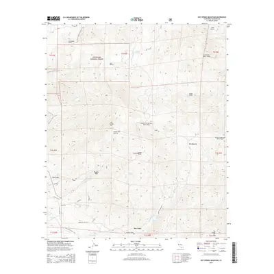
2015 Map of Hot Springs Mountain
USGS Topo · Published 2015About this map
Cleveland National Forest and its high-elevation terrain dominate this mid-2010s study of San Diego County. The area is characterized by a network of isolated settlements and specialized outposts like Eagles Nest, San Ignacio, and Los Tules, connected by a complex web of named local routes including Los Coyotes Rd and Camino San Ignacio Rd. The topography rises steeply toward Hot Springs Mtn, where the landscape is carved by deep canyons such as Middle Fork Borrego Palm Canyon and Sheep Canyon. This period shows the enduring path of the Pacific Crest National Scenic Trail as it traverses the western ridges above Chihuahua Valley. Notable water sources like Blackwater Hole and Panawatt Springs indicate critical landmarks in this arid environment, while the presence of San Ysidro at the southern base of San Ysidro Mtn reflects the established habitation patterns of the San Luis Rey river drainage system.
Find a feature on this map
45 named features on this map. Tap any name to fly to it.
Don’t see what you’re looking for? This feature index may not catch every label — zoom into the map to look around manually.
Map Details
Editions of this 2015 Hot Springs Mountain Map
This is the sole edition of this map. No revisions or reprints were ever made.
Other maps of this area

1903 · Ramona
USGS Topo · 1:125,000

1904 · Indio
USGS Topo · 1:125,000

1904 · Southern California Sheet No. 2
USGS Topo · 1:250,000

1931 · Vallecito
USGS Topo · 1:125,000

1939 · Warner Springs
USGS Topo · 1:62,500

1939 · Santa Ysabel
USGS Topo · 1:62,500

1939 · Borrego
USGS Topo · 1:62,500

1941 · Clark Lake
USGS Topo · 1:62,500

1942 · Clark Lake
USGS Topo · 1:62,500

1942 · Borego
USGS Topo · 1:62,500