1942 Map of Clark Lake
USGS Topo · Published 1942About this map
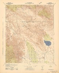
The Santa Rosa Mountains and San Isidro Mountain tower over this arid landscape, where desert water sources like Hidden Springs, Clark Well, and Santa Caterina Springs dictated early settlement and travel. During the early 1940s, the region was evolving from an isolated cattle-ranching frontier into a protected wilderness, as seen in the designation of Anza Borrego State Park.
Find a feature on this map
38 named features on this map. Tap any name to fly to it.
Don’t see what you’re looking for? This feature index may not catch every label — zoom into the map to look around manually.
Map Details
Editions of this 1942 Clark Lake Map
2 editions found

Other maps of this area

1901 · Southern California Sheet No. 1
USGS Topo · 1:250,000

1901 · San Jacinto
USGS Topo · 1:125,000

1903 · Ramona
USGS Topo · 1:125,000

1904 · Indio
USGS Topo · 1:125,000

1904 · Southern California Sheet No. 2
USGS Topo · 1:250,000

1904 · Southern California Sheet No. 1
USGS Topo · 1:250,000

1931 · Vallecito
USGS Topo · 1:125,000

1939 · Warner Springs
USGS Topo · 1:62,500

1939 · Santa Ysabel
USGS Topo · 1:62,500

1939 · Borrego
USGS Topo · 1:62,500