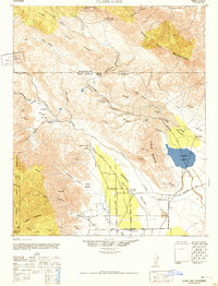
1942 Map of Clark Lake
USGS Topo · Published 1952About this map
The Santa Rosa Mountains and Buck Ridge define the northern reaches of this arid landscape, dropping sharply into the vast Borego Valley and Clark Valley. Surveyed in the early 1940s, the map documents a sparse but vital network of springs and desert trails essential for survival in this terrain. The historic Old Santa Rosa Indian Ruins sit high in the mountains, while the lower valleys show the early agricultural footprint of the Brinnizer Ranch and Rancho De Anza. This era of the desert's history is characterized by isolated outposts like Clark Well and small educational hubs such as Canyon School and Borrego Sch, connected by the storied De Anza Trail and the emerging De Anza Road. The seasonal nature of the landscape is evident in the expanse of Clark Lake and the numerous named washes and canyons including Indian Canyon and Rockhouse Canyon.
Find a feature on this map
69 named features on this map. Tap any name to fly to it.
Don’t see what you’re looking for? This feature index may not catch every label — zoom into the map to look around manually.
Map Details
Editions of this 1942 Clark Lake Map
2 editions found

Other maps of this area

1901 · Southern California Sheet No. 1
USGS Topo · 1:250,000

1901 · San Jacinto
USGS Topo · 1:125,000

1903 · Ramona
USGS Topo · 1:125,000

1904 · Indio
USGS Topo · 1:125,000

1904 · Southern California Sheet No. 2
USGS Topo · 1:250,000

1904 · Southern California Sheet No. 1
USGS Topo · 1:250,000

1931 · Vallecito
USGS Topo · 1:125,000

1939 · Warner Springs
USGS Topo · 1:62,500

1939 · Santa Ysabel
USGS Topo · 1:62,500

1939 · Borrego
USGS Topo · 1:62,500