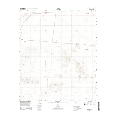
2014 Map of Hotason Vo
USGS Topo · Published 2014About this map
Hotason Vo and the surrounding Sonoran Desert landscape are defined by a network of drainage channels and isolated peaks in this 2014 survey. The map details the drainage patterns of Sikort Chuapo Wash and Gunsight Wash, which navigate the arid terrain between the Gunsight Hills and Ninemile Peak. This area in Pima County reflects a traditional landscape where small settlements like Kavolik and the broad Quijotoa Valley are connected by rural routes such as Az-86 and various Bureau of Indian Affairs roads. The presence of Chagit Vo and several named hills provides critical landmarks in a region where topography dictates the flow of seasonal water and human movement. Genealogists and historians can use these precise coordinates to locate specific homesteads or community centers within the Tohono O'odham Nation, documenting the modern footprint of these ancestral lands.
Find a feature on this map
20 named features on this map. Tap any name to fly to it.
Don’t see what you’re looking for? This feature index may not catch every label — zoom into the map to look around manually.
Map Details
Editions of this 2014 Hotason Vo Map
This is the sole edition of this map. No revisions or reprints were ever made.
Other maps of this area

1953 · Ajo
USGS Topo · 1:250,000

1957 · Ajo
USGS Topo · 1:250,000

1958 · Ajo
USGS Topo · 1:250,000

1962 · Ajo
USGS Topo · 1:250,000

1963 · Ajo
USGS Topo · 1:250,000

1963 · Sikort Chuapo Mts
USGS Topo · 1:62,500

1963 · Mt. Ajo
USGS Topo · 1:62,500

1963 · Cimarron Peak
USGS Topo · 1:62,500

1963 · Pisinimo
USGS Topo · 1:62,500

1967 · Ajo
USGS Topo · 1:250,000