
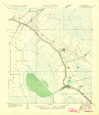
1932 Map of Houma NE
USGS Topo · Published 1932About this map
Bayou Lafourche dictates the movement of people and goods in this 1932 survey, with settlements like Raceland and Lockport tightly hugging the waterway. This ribbon-like development pattern is a classic Louisiana cultural landscape, where long, narrow land grants extend away from the water. The transport network is a complex layering of old and new, featuring the Southern Pacific railroad alongside expanding routes like State Highway No 2.
Find a feature on this map
37 named features on this map. Tap any name to fly to it.
Don’t see what you’re looking for? This feature index may not catch every label — zoom into the map to look around manually.
Map Details
Editions of this 1932 Houma NE Map
2 editions found
Other maps of this area

1891 · Hahnville
USGS Topo · 1:62,500

1892 · Lac Des Allemands
USGS Topo · 1:62,500

1892 · Cut-Off
USGS Topo · 1:62,500

1892 · Houma
USGS Topo · 1:62,500

1932 · Houma SE
USGS Topo · 1:31,680

1932 · Lac Des Allemands SE
USGS Topo · 1:31,680

1932 · Lac Des Allemands SW
USGS Topo · 1:31,680

1932 · Houma SW
USGS Topo · 1:31,680

1932 · Houma NW
USGS Topo · 1:31,680

1932 · Hahnville SW
USGS Topo · 1:31,680