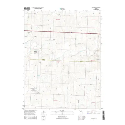
2014 Map of Houstonia
USGS Topo · Published 2014About this map
The town of Houstonia anchors the southwest corner of this Pettis and Saline County landscape, where the agricultural grid meets the winding course of the Blackwater River. The terrain is defined by its drainage systems, with Buffalo Cr and May Br flowing south toward the town site, while Coppers Cr carves through the northern hills near Coppers Hill. Local history is preserved in several rural burial grounds, including Houstonia Cemetery, Rose Valley Cemetery, and Oak Grove Cemetery, which are scattered among the section lines and gravel roads. To the east, the small settlement of Tedieville stands near the headwaters of Hess Cr, while McAllister Springs sits along the river, marking a point of geological interest alongside Shanz Stockman Spring. The map documents a predominantly rural economy where managed water resources like Raymond Wicker Lake support the surrounding farmsteads and township ranges.
Find a feature on this map
65 named features on this map. Tap any name to fly to it.
Don’t see what you’re looking for? This feature index may not catch every label — zoom into the map to look around manually.
Map Details
Editions of this 2014 Houstonia Map
This is the sole edition of this map. No revisions or reprints were ever made.
Other maps of this area

1887 · Sedalia
USGS Topo · 1:125,000

1890 · Marshall
USGS Topo · 1:125,000

1892 · Marshall
USGS Topo · 1:125,000

1894 · Sedalia
USGS Topo · 1:125,000

1901 · Marshall
USGS Topo · 1:125,000

1939 · Sweet Springs
USGS Topo · 1:62,500

1940 · Sweet Springs
USGS Topo · 1:62,500

1940 · Marshall
USGS Topo · 1:62,500

1941 · Sweet Springs
USGS Topo · 1:62,500

1944 · Marshall
USGS Topo · 1:62,500