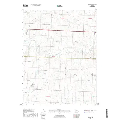
2017 Map of Houstonia
USGS Topo · Published 2017About this map
Houstonia anchors the southwestern corner of this West-Central Missouri landscape, where the town layout is defined by its simple street grid near Buffalo Cr. The surrounding terrain is a network of watercourses, with the Blackwater River and several of its tributaries, including Coppers Cr and Grassy Cr, carving through the agricultural landscape. Local history is preserved in several rural burial grounds such as Houstonia Cem, Oak Grove Cem, and Rose Valley Cem, which serve as quiet landmarks for genealogists. The topography is largely gentle, punctuated by features like Coppers Hill and the recreational waters of Raymond Wicker Lake. Further north, McAllister Springs and Shanz Stockman Spring indicate the area's natural hydrology, while the boundary between Saline and Pettis counties bisects the map, illustrating how political lines were drawn across this creek-threaded prairie.
Find a feature on this map
67 named features on this map. Tap any name to fly to it.
Don’t see what you’re looking for? This feature index may not catch every label — zoom into the map to look around manually.
Map Details
Editions of this 2017 Houstonia Map
This is the sole edition of this map. No revisions or reprints were ever made.
Other maps of this area

1887 · Sedalia
USGS Topo · 1:125,000

1890 · Marshall
USGS Topo · 1:125,000

1892 · Marshall
USGS Topo · 1:125,000

1894 · Sedalia
USGS Topo · 1:125,000

1901 · Marshall
USGS Topo · 1:125,000

1939 · Sweet Springs
USGS Topo · 1:62,500

1940 · Sweet Springs
USGS Topo · 1:62,500

1940 · Marshall
USGS Topo · 1:62,500

1941 · Sweet Springs
USGS Topo · 1:62,500

1944 · Marshall
USGS Topo · 1:62,500