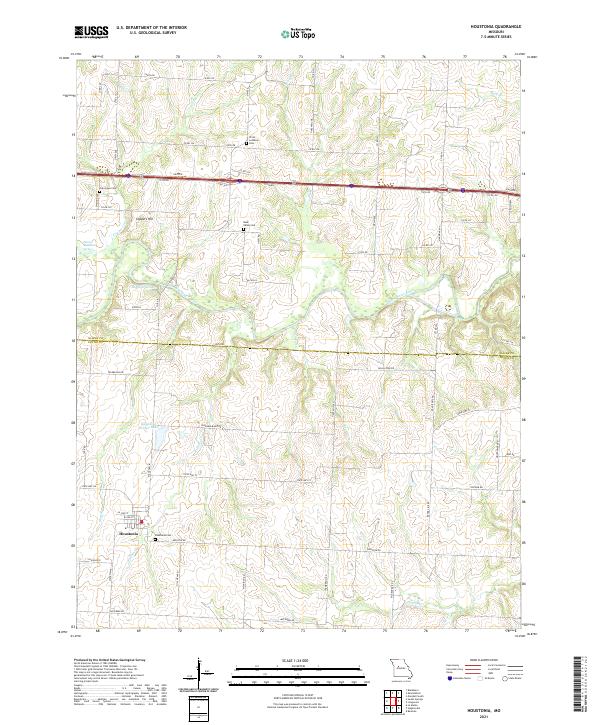
2021 Map of Houstonia
USGS Topo · Published 2021About this map
Houstonia anchors the southwestern corner of this Pettis County landscape, where the street grid of W 3rd St and W 2nd St transitions into a network of rural routes. The terrain is defined by the winding course of the Blackwater River, which meanders across the northern half of the region. Local history is etched into the land through numerous small burial sites, including Houstonia Cem, Rose Valley Cem, Oak Grove Cem, and Christ Lutheran Cem, each serving as a marker for the area's early families and agricultural communities.
Find a feature on this map
44 named features on this map. Tap any name to fly to it.
Don’t see what you’re looking for? This feature index may not catch every label — zoom into the map to look around manually.
Map Details
Editions of this 2021 Houstonia Map
This is the sole edition of this map. No revisions or reprints were ever made.
Other maps of this area

1887 · Sedalia
USGS Topo · 1:125,000

1890 · Marshall
USGS Topo · 1:125,000

1892 · Marshall
USGS Topo · 1:125,000

1894 · Sedalia
USGS Topo · 1:125,000

1901 · Marshall
USGS Topo · 1:125,000

1939 · Sweet Springs
USGS Topo · 1:62,500

1940 · Sweet Springs
USGS Topo · 1:62,500

1940 · Marshall
USGS Topo · 1:62,500

1941 · Sweet Springs
USGS Topo · 1:62,500

1944 · Marshall
USGS Topo · 1:62,500