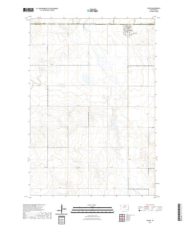
2021 Map of Hoven
USGS Topo · Published 2021About this map
Hoven serves as the primary hub of this prairie landscape, situated near the boundary between Walworth Co and Potter Co. The town's grid is clearly defined by historical thoroughfares such as Main St, O'Gorman St, and Bubik St, reflecting a community structured around its central core. To the east of the residential area lies the Saint Anthony Catholic Cem, a focal point for genealogical research and local history. Beyond the town limits, the landscape transitions into the vast agricultural township system, marked by section lines like 148th St and 319th Ave. This survey illustrates the enduring rural infrastructure of the South Dakota plains, where the intersection of county lines and local streets tells the story of early twentieth-century settlement patterns preserved into the modern era.
Find a feature on this map
39 named features on this map. Tap any name to fly to it.
Don’t see what you’re looking for? This feature index may not catch every label — zoom into the map to look around manually.
Map Details
Editions of this 2021 Hoven Map
This is the sole edition of this map. No revisions or reprints were ever made.
Other maps of this area

1954 · Aberdeen
USGS Topo · 1:250,000

1956 · Aberdeen
USGS Topo · 1:250,000

1974 · Lowry
USGS Topo · 1:24,000

1974 · Hoven
USGS Topo · 1:24,000

1974 · Hoven Muni. Airport
USGS Topo · 1:24,000
1974 · Flight Lake
USGS Topo · 1:24,000
1978 · Gettysburg
USGS Topo · 1:24,000

1978 · Seneca NW
USGS Topo · 1:24,000
1978 · Seneca SW
USGS Topo · 1:24,000

1978 · Bowdle SW
USGS Topo · 1:24,000