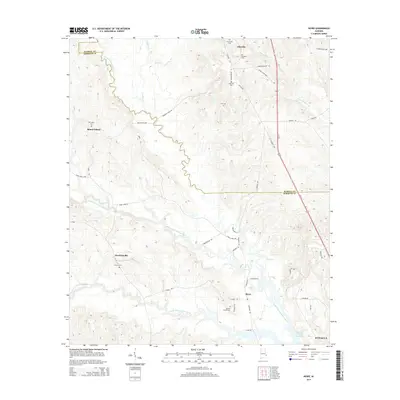
2014 Map of Howe
USGS Topo · Published 2014About this map
Howe and the surrounding Barbour County countryside appear as a landscape of rural hamlets and winding creek drainages in this 2014 survey. The topography is defined by the three forks of Cowikee Creek, including the Middle Fork Cowikee Creek and South Fork Cowikee Creek, which move eastward toward the Walter F George Reservoir. Historically significant family and community hubs are noted through numerous burial grounds, such as Mt Gilead Cem near Mount Gilead and the Tennell Chapel Cem south of Howe. The network of local roads like Barbour Creek Rd and Stovall Rd connects smaller settlements such as Hawkinsville and Glenville. This modern topographic record captures the enduring rural character of the area just north of Eufaula, where agriculture and hydrology remain the dominant features.
Find a feature on this map
44 named features on this map. Tap any name to fly to it.
Don’t see what you’re looking for? This feature index may not catch every label — zoom into the map to look around manually.
Map Details
Editions of this 2014 Howe Map
This is the sole edition of this map. No revisions or reprints were ever made.
Other maps of this area

1953 · Dothan
USGS Topo · 1:250,000

1954 · Dothan
USGS Topo · 1:250,000

1955 · Dothan
USGS Topo · 1:250,000

1955 · Phenix City
USGS Topo · 1:250,000

1957 · Phenix City
USGS Topo · 1:250,000
1957 · Pittsview
USGS Topo · 1:24,000
1957 · Omaha
USGS Topo · 1:24,000

1958 · Phenix City
USGS Topo · 1:250,000

1967 · Georgetown
USGS Topo · 1:24,000

1968 · Eufaula North
USGS Topo · 1:24,000