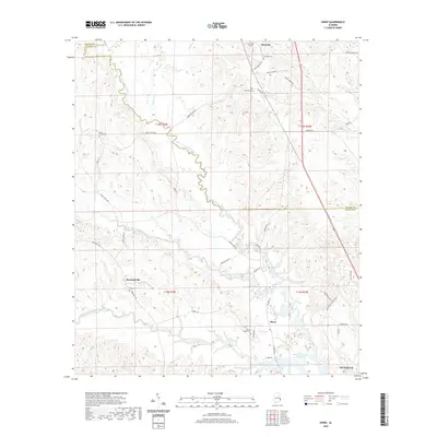
2020 Map of Howe
USGS Topo · Published 2020About this map
The Walter F George Reservoir backwaters meet the rolling woodlands of eastern Alabama in this modern geographic study. The landscape is defined by the complex drainage systems of the North Fork Cowikee Creek, Middle Fork Cowikee Creek, and South Fork Cowikee Creek, which converge as they move toward the Chattahoochee River basin. Small rural settlements like Glenville, Hawkinsville, and Howe remain central points of reference for the surrounding agricultural and timber lands.
Find a feature on this map
49 named features on this map. Tap any name to fly to it.
Don’t see what you’re looking for? This feature index may not catch every label — zoom into the map to look around manually.
Map Details
Editions of this 2020 Howe Map
This is the sole edition of this map. No revisions or reprints were ever made.
Other maps of this area

1953 · Dothan
USGS Topo · 1:250,000

1954 · Dothan
USGS Topo · 1:250,000

1955 · Dothan
USGS Topo · 1:250,000

1955 · Phenix City
USGS Topo · 1:250,000

1957 · Phenix City
USGS Topo · 1:250,000
1957 · Pittsview
USGS Topo · 1:24,000
1957 · Omaha
USGS Topo · 1:24,000

1958 · Phenix City
USGS Topo · 1:250,000

1967 · Georgetown
USGS Topo · 1:24,000

1968 · Eufaula North
USGS Topo · 1:24,000