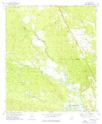
1973 Map of Howe
USGS Topo · Published 1976About this map
Glenville and the surrounding rural landscapes of the Russell Co and Barbour Co border are defined by the winding hydrology of the Cowikee Creek system. The North Fork, Middle Fork, and South Fork converge as they flow toward the Walter F George Reservoir and the Eufaula National Wildlife Refuge in the southeast. This 1970s survey captures a landscape of small agricultural settlements and dispersed homesteads, connected by a network of churches and family cemeteries.
Find a feature on this map
30 named features on this map. Tap any name to fly to it.
Don’t see what you’re looking for? This feature index may not catch every label — zoom into the map to look around manually.
Map Details
Editions of this 1973 Howe Map
2 editions found
Other maps of this area

1953 · Dothan
USGS Topo · 1:250,000

1954 · Dothan
USGS Topo · 1:250,000

1955 · Dothan
USGS Topo · 1:250,000

1955 · Phenix City
USGS Topo · 1:250,000

1957 · Phenix City
USGS Topo · 1:250,000
1957 · Pittsview
USGS Topo · 1:24,000
1957 · Omaha
USGS Topo · 1:24,000

1958 · Phenix City
USGS Topo · 1:250,000

1967 · Georgetown
USGS Topo · 1:24,000

1968 · Eufaula North
USGS Topo · 1:24,000