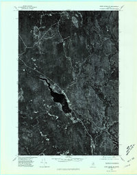
1975 Map of Howe Brook SW
USGS Topo · Published 1981About this map
St Croix Stream snakes through this heavily forested section of Aroostook County, serving as the central drainage for a landscape defined by industrial timberlands and secluded watercourses. In the mid-1970s, the small settlements of Weeksboro and Howe Brook remained the primary human imprints on this remote Maine territory. The orthophotographic perspective reveals the dense network of logging roads and clearings that support the region's forest products economy, contrasting with the dark, untouched slopes of Howe Brook Mountain. Genealogists and local historians can trace the proximity of these vanished or reduced rail-stop settlements to the surrounding water bodies like Beaver Brook and Weeks Brook, providing a clear spatial context for 20th-century life in the deep northern woods before modern forest management changed the canopy's footprint.
Find a feature on this map
7 named features on this map. Tap any name to fly to it.
Don’t see what you’re looking for? This feature index may not catch every label — zoom into the map to look around manually.
Map Details
Editions of this 1975 Howe Brook SW Map
This is the sole edition of this map. No revisions or reprints were ever made.
Other maps of this area

1935 · Howe Brook
USGS Topo · 1:48,000

1937 · Smyrna Mills
USGS Topo · 1:62,500

1939 · Howe Brook
USGS Topo · 1:62,500

1940 · Island Falls
USGS Topo · 1:62,500

1940 · Oxbow
USGS Topo · 1:62,500

1942 · Island Falls
USGS Topo · 1:62,500

1942 · Oxbow
USGS Topo · 1:62,500

1954 · Howe Brook
USGS Topo · 1:62,500

1954 · Presque Isle
USGS Topo · 1:250,000

1955 · Smyrna Mills
USGS Topo · 1:62,500
Featured Places
- Howe Brook, Saint Croix Township
- Little Canada, Saint Croix Township
- Weeksboro, Dudley Township
- Webbertown Township, ME
- Dudley Township, ME