2024 Map of Hoyleton
USGS Topo · Published 2024About this map
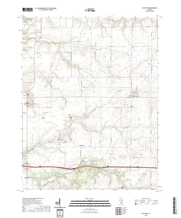
Hoyleton and New Minden anchor this portion of Washington County, illustrating a landscape defined by organized rural settlement and a precise grid of country roads. The area is marked by numerous historic burial grounds that speak to the genealogy of local communities, including Saint Johns Cem near the western edge and Trinity Cem within the village of Hoyleton. Small hamlets like Huegely and North Prairie are connected by a network of family-named and tree-named thoroughfares such as Sassafras Rd, Mulberry Rd, and Dogwood Rd.
Find a feature on this map
58 named features on this map. Tap any name to fly to it.
Don’t see what you’re looking for? This feature index may not catch every label — zoom into the map to look around manually.
Map Details
Editions of this 2024 Hoyleton Map
This is the sole edition of this map. No revisions or reprints were ever made.
Historical Maps of Clinton County Through Time
3 maps found