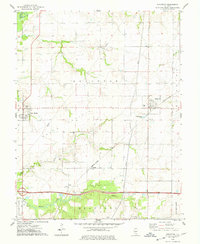
1974 Map of Hoyleton
USGS Topo · Published 1978About this map
Hoyleton Prairie defines the central landscape of this Washington County survey, where agricultural land meets the drainages of Crooked Creek and Coon Creek. The settlement of Hoyleton serves as a local hub along the Missouri - Illinois rail line, showing a concentrated grid of streets and specialized features like a Sewage Disposal Pond. Further west, the village of New Minden and the smaller locality of Huegely anchor the rural road network. Genealogists will find this sheet particularly valuable for its density of burial sites and religious landmarks, including St Johns Ch, Trinity Cem, and Pleasant Grove Ch Cem. The transition from the northern Base Line down into the township of Beaucoup reflects the region's mid-20th-century development, where traditional farmsteads and rural churches remained the pillars of the community.
Find a feature on this map
32 named features on this map. Tap any name to fly to it.
Don’t see what you’re looking for? This feature index may not catch every label — zoom into the map to look around manually.
Map Details
Editions of this 1974 Hoyleton Map
This is the sole edition of this map. No revisions or reprints were ever made.
Other maps of this area

1910 · Carlyle
USGS Topo · 1:62,500

1914 · Centralia
USGS Topo · 1:62,500

1931 · Hoyleton
USGS Topo · 1:48,000

1932 · Nashville
USGS Topo · 1:62,500

1935 · Centralia
USGS Topo · 1:62,500

1936 · Nashville
USGS Topo · 1:62,500

1943 · Ashley
USGS Topo · 1:62,500

1946 · Ashley
USGS Topo · 1:62,500

1948 · Carlyle
USGS Topo · 1:62,500

1958 · Belleville
USGS Topo · 1:250,000