
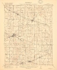
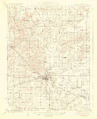
1931 Map of Hoyleton
USGS Topo · Published 1931About this map
Nashville serves as the prominent hub of activity on this 1931 survey, positioned at the intersection of critical transit corridors and serving as a focal point for the surrounding agricultural community. The landscape is interconnected by the Louisville and Nashville Railroad and the Missouri Illinois Railroad, which supported the movement of goods through townships like Hoyleton and Covington. Beyond the rail lines, the early automotive era is represented by Illinois State Highway No 15, marking a period when paved routes began to transform rural connectivity.
Find a feature on this map
39 named features on this map. Tap any name to fly to it.
Don’t see what you’re looking for? This feature index may not catch every label — zoom into the map to look around manually.
Map Details
Editions of this 1931 Hoyleton Map
This is the sole edition of this map. No revisions or reprints were ever made.
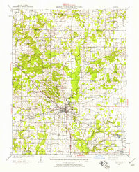
Other maps of this area

1906 · Breese
USGS Topo · 1:62,500

1907 · Breese
USGS Topo · 1:62,500

1910 · Carlyle
USGS Topo · 1:62,500

1910 · Okawville
USGS Topo · 1:62,500

1914 · Centralia
USGS Topo · 1:62,500

1914 · Coulterville
USGS Topo · 1:62,500
1917 · Coulterville
USGS Topo · 1:62,500
1924 · Pinckneyville
USGS Topo · 1:62,500
1926 · Pinckneyville
USGS Topo · 1:62,500

1926 · Duquoin
USGS Topo · 1:62,500