
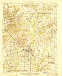
1926 Map of Pinckneyville
USGS Topo · Published 1926About this map
Pinckneyville serves as the focal point of this 1920s survey, situated at the junction of the Illinois Central and the Wabash Chester and Western railroads. The landscape is heavily defined by its transition from agrarian roots to a burgeoning mining economy, evidenced by the Victory Coal Mine and Panther Mine in the southern sections. Local education and community life are well-documented through a dense network of country schools, including the Round Prairie School, Shakerag School, and St Marys School.
Find a feature on this map
75 named features on this map. Tap any name to fly to it.
Don’t see what you’re looking for? This feature index may not catch every label — zoom into the map to look around manually.
Map Details
Editions of this 1926 Pinckneyville Map
2 editions found
Other maps of this area

1910 · Herrin
USGS Topo · 1:62,500

1910 · Murphysboro
USGS Topo · 1:62,500

1910 · Okawville
USGS Topo · 1:62,500

1914 · Coulterville
USGS Topo · 1:62,500

1916 · Campbell Hill
USGS Topo · 1:62,500

1917 · Coulterville
USGS Topo · 1:62,500

1918 · Campbell Hill
USGS Topo · 1:62,500

1924 · Pinckneyville
USGS Topo · 1:62,500

1926 · Duquoin
USGS Topo · 1:62,500

1931 · Hoyleton
USGS Topo · 1:48,000