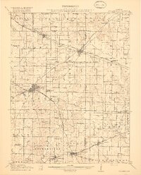
1917 Map of Coulterville
USGS Topo · Published 1917About this map
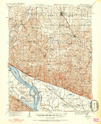
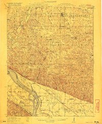
Coulterville and Sparta serve as the primary hubs of this Southern Illinois landscape during a period of significant agricultural and industrial expansion. The territory is crisscrossed by a dense network of competing rail lines, including the Illinois Central, Mobile and Ohio, and the Illinois Southern, which facilitated the movement of goods through the Grande Cote Prairie. This survey captures a moment when rural life centered around a remarkable density of neighborhood schoolhouses, such as Lost Prairie School, Gravel Hill School, and Scotland School, most of which were positioned within walking distance of the era’s dispersed farmsteads. The drainage systems of the Marys River and Galum Creek provide the topographic structure for the surrounding townships of Lively Grove and Marissa, illustrating how early 20th-century settlement patterns were dictated by both the fertile prairie land and the strategic placement of railroad junctions.
Find a feature on this map
90 named features on this map. Tap any name to fly to it.
Don’t see what you’re looking for? This feature index may not catch every label — zoom into the map to look around manually.
Map Details
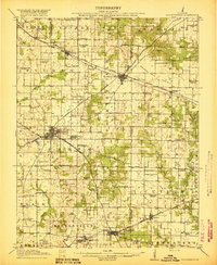
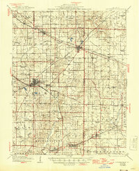
Editions of this 1917 Coulterville Map
3 editions found
Other maps of this area
1910 · Murphysboro
USGS Topo · 1:62,500

1910 · Okawville
USGS Topo · 1:62,500

1912 · New Athens
USGS Topo · 1:62,500

1912 · Baldwin
USGS Topo · 1:62,500

1914 · Baldwin
USGS Topo · 1:62,500

1914 · Coulterville
USGS Topo · 1:62,500

1915 · Chester
USGS Topo · 1:62,500
1916 · Campbell Hill
USGS Topo · 1:62,500
1918 · Campbell Hill
USGS Topo · 1:62,500
1924 · Pinckneyville
USGS Topo · 1:62,500