
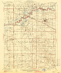
1910 Map of Okawville
USGS Topo · Published 1910About this map
The Kaskaskia River snakes through the center of this Illinois landscape, creating a complex wetland environment of oxbows and backwaters like Calamus Lake, Halfmoon Lake, and Muddy Lake. The drainage basin defines the local geography, with numerous tributaries such as Elkhorn Creek and Plum Creek carving through the prairie. Settlement patterns are dictated by the terrain and the vital Louisville & Nashville RR, which connects agricultural centers like Okawville and New Memphis Sta.
Find a feature on this map
56 named features on this map. Tap any name to fly to it.
Don’t see what you’re looking for? This feature index may not catch every label — zoom into the map to look around manually.
Map Details
Editions of this 1910 Okawville Map
2 editions found
Other maps of this area

1906 · Breese
USGS Topo · 1:62,500

1907 · Breese
USGS Topo · 1:62,500

1907 · Belleville
USGS Topo · 1:62,500

1910 · Carlyle
USGS Topo · 1:62,500

1912 · New Athens
USGS Topo · 1:62,500

1912 · Baldwin
USGS Topo · 1:62,500

1914 · Baldwin
USGS Topo · 1:62,500

1914 · Coulterville
USGS Topo · 1:62,500

1917 · Coulterville
USGS Topo · 1:62,500

1924 · Pinckneyville
USGS Topo · 1:62,500