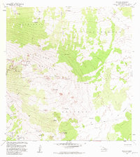
1982 Map of Hualalai
USGS Topo · Published 1982About this map
The ancient Ahu a Umi Heiau stands as a significant cultural landmark on the slopes of Hualalai in the early 1980s, situated within a landscape defined by volcanic activity and conservation. The map documents the extensive Lava Flow of 1859 cutting across the northern reaches of Puu Anahulu and Puu Wa Aw Aa. This transition from high-elevation forest reserves, such as the Kaupulehu Forest Reserve, to the stark lava fields illustrates the island's ongoing geological evolution. Historic transportation routes like the Judd Trail and Pihapono Trail provide passage through these varying terrains, connecting numerous cinder cones and craters including Hainoa Crater and Puu Lajakaukole. The presence of water tanks and a Corral near Puu o Mawae reflects the mid-century ranching and resource management efforts that shaped land use in the North Kona District.
Find a feature on this map
44 named features on this map. Tap any name to fly to it.
Don’t see what you’re looking for? This feature index may not catch every label — zoom into the map to look around manually.
Map Details
Editions of this 1982 Hualalai Map
2 editions found
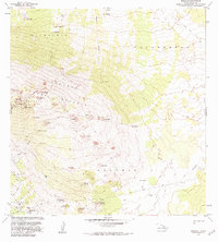
Other maps of this area

1927 · Kaohe
USGS Topo · 1:62,500

1928 · Puako
USGS Topo · 1:62,500

1928 · Kailua
USGS Topo · 1:62,500

1930 · Kaohe
USGS Topo · 1:62,500

1954 · Hawaii North
USGS Topo · 1:250,000

1956 · Keamuku
USGS Topo · 1:24,000

1956 · Puu O Uo
USGS Topo · 1:24,000

1956 · Naohueleelua
USGS Topo · 1:24,000

1959 · Hawaii North
USGS Topo · 1:250,000

1959 · Kiholo
USGS Topo · 1:24,000