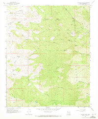
1968 Map of Hualapai Peak
USGS Topo · Published 1971About this map
Hualapai Mountain Park dominates this high-elevation landscape, where the peaks provide a stark vertical contrast to the desert floor. In the late 1960s, the area served as a significant recreational and communication hub, evidenced by Camp Stephens, Camp Levi Levi, and several Radio Facilities perched on the heights of Hayden Peak. The complex terrain is carved by deep drainages like Cottonwood Canyon and Horse Canyon, which are navigated by an extensive network of Jeep Trails and Pack Trails.
Find a feature on this map
40 named features on this map. Tap any name to fly to it.
Don’t see what you’re looking for? This feature index may not catch every label — zoom into the map to look around manually.
Map Details
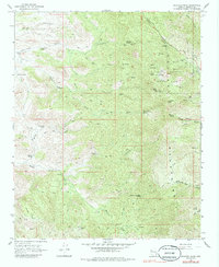
Editions of this 1968 Hualapai Peak Map
2 editions found
Other maps of this area

1886 · Diamond Creek
USGS Topo · 1:250,000

1886 · Camp Mohave
USGS Topo · 1:250,000

1892 · Diamond Creek
USGS Topo · 1:250,000

1892 · Camp Mohave
USGS Topo · 1:250,000

1923 · Signal
USGS Topo · 1:250,000

1927 · Yucca
USGS Topo · 1:62,500

1929 · Yucca
USGS Topo · 1:62,500

1942 · Camp Mohave
USGS Topo · 1:250,000

1942 · Signal
USGS Topo · 1:250,000

1947 · Kingman
USGS Topo · 1:250,000