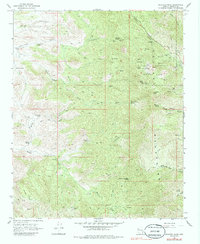
1968 Map of Hualapai Peak
USGS Topo · Published 1986About this map
The high summits of the Hualapai Mountains dominate this late 1960s survey, defined by significant vertical relief and a network of named springs that once supported mining and recreation in this arid Arizona landscape. Historic mountain activity is centered around the Hualapai Mountain Park, where campgrounds and picnic areas sit near Camp Levi Levi and Camp Stephens. Notable peaks including Hualapai Peak and Hayden Peak are surrounded by numerous water sources, such as Black Inky Spring, Wild Cow Spring, and Yellow Flower Spring. Evidence of early 20th-century industry persists through the Flag Mine and Walnut Creek Mine, while the terrain is traversed by a complex system of Jeep Trails and Pack Trails. The presence of several Radio Facilities at the higher elevations underscores the transition to modern telecommunications during this period.
Find a feature on this map
81 named features on this map. Tap any name to fly to it.
Don’t see what you’re looking for? This feature index may not catch every label — zoom into the map to look around manually.
Map Details
Editions of this 1968 Hualapai Peak Map
2 editions found
Other maps of this area

1886 · Diamond Creek
USGS Topo · 1:250,000

1886 · Camp Mohave
USGS Topo · 1:250,000

1892 · Diamond Creek
USGS Topo · 1:250,000

1892 · Camp Mohave
USGS Topo · 1:250,000

1923 · Signal
USGS Topo · 1:250,000

1927 · Yucca
USGS Topo · 1:62,500

1929 · Yucca
USGS Topo · 1:62,500

1942 · Camp Mohave
USGS Topo · 1:250,000

1942 · Signal
USGS Topo · 1:250,000

1947 · Kingman
USGS Topo · 1:250,000