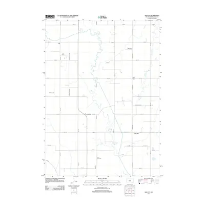
2012 Map of Hub City
USGS Topo · Published 2012About this map
The Vermillion River meanders southward through this rural landscape of Clay County, defining the agricultural character of the region. Local history and genealogy are centered around established settlements and burial grounds such as Spirit Mound Cem, Lodi Cem, and Clay Point Cem. The map illustrates a grid of section roads like Pleasant Valley Ave and University Rd that connect small communities including Hub City, Bloomingdale, Lodi, and Dalesburg. The presence of the Lodi Airport near the northwest corner and the topographical distinction of Cabbage Flat offer insights into the local land use and transportation during the early 21st century. The drainage patterns of Baptist Cr further delineate the township's physical geography, supporting a network of farmsteads and rural residences.
Find a feature on this map
33 named features on this map. Tap any name to fly to it.
Don’t see what you’re looking for? This feature index may not catch every label — zoom into the map to look around manually.
Map Details
Editions of this 2012 Hub City Map
This is the sole edition of this map. No revisions or reprints were ever made.
Other maps of this area

1897 · Canton
USGS Topo · 1:125,000

1898 · Parker
USGS Topo · 1:125,000

1898 · Elk Point
USGS Topo · 1:125,000

1900 · Canton
USGS Topo · 1:125,000

1901 · Elk Point
USGS Topo · 1:125,000

1907 · Elk Point
USGS Topo · 1:125,000

1955 · Sioux City
USGS Topo · 1:250,000

1955 · Sioux Falls
USGS Topo · 1:250,000

1958 · Sioux City
USGS Topo · 1:250,000

1958 · Sioux Falls
USGS Topo · 1:250,000