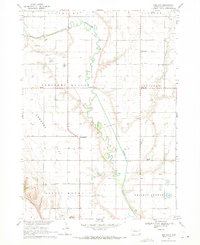
1969 Map of Hub City
USGS Topo · Published 1971About this map
The Vermillion River meanders through the heart of this landscape, carving a wide valley between the uplands of Pleasant Valley and the prominent rising of Spirit Mound to the south. This late-1960s survey documents a tightly knit rural community defined by its township structure and distinct local hubs like Hub City and Dalesburg. The presence of several dedicated community markers, including Dalesburg Sch and the Garfield Tabernacle, suggests a well-established social fabric centered around township halls and country parishes. For genealogists, the map is particularly valuable for its clear marking of local burial sites such as Lodi Cem, Dalesburg Cem, and Clay Point Cem, alongside smaller family or church-affiliated settlements like Bloomingdale and Lodi. The land use is dominated by agriculture and resource extraction, evidenced by various Gravel Pits scattered across the township lines.
Find a feature on this map
25 named features on this map. Tap any name to fly to it.
Don’t see what you’re looking for? This feature index may not catch every label — zoom into the map to look around manually.
Map Details
Editions of this 1969 Hub City Map
This is the sole edition of this map. No revisions or reprints were ever made.
Other maps of this area

1897 · Canton
USGS Topo · 1:125,000

1898 · Parker
USGS Topo · 1:125,000

1898 · Elk Point
USGS Topo · 1:125,000

1900 · Canton
USGS Topo · 1:125,000

1901 · Elk Point
USGS Topo · 1:125,000

1907 · Elk Point
USGS Topo · 1:125,000

1955 · Sioux City
USGS Topo · 1:250,000

1955 · Sioux Falls
USGS Topo · 1:250,000

1958 · Sioux City
USGS Topo · 1:250,000

1958 · Sioux Falls
USGS Topo · 1:250,000