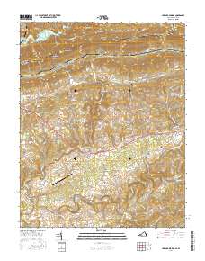
2016 Map of Hubbard Springs
USGS Topo · Published 2016About this map
Cumberland Mountain forms the northern boundary of this Lee County landscape, where the historic Wilderness Rd and Daniel Boone Trl track through the heart of the valley. This transit corridor anchors local life, passing near the Jonesville Camp Ground and connecting rural communities like Hubbard Springs, Ocoonita, and Fleentown. The topography is defined by alternating ridges and valleys, including Poor Valley and Chestnut Ridge, which dictate the placement of local homesteads and small family burial grounds such as McClure Cem and Hamblin Cem. To the south, the Powell River meanders near White Shoals, crossed by the Hurricane Bridge. The presence of the Wagonroad Tunnel at Hubbard Springs Gap and the Lee County Airport illustrates the evolution of travel in this Appalachian corridor from early migration routes to modern infrastructure.
Find a feature on this map
123 named features on this map. Tap any name to fly to it.
Don’t see what you’re looking for? This feature index may not catch every label — zoom into the map to look around manually.
Map Details
Editions of this 2016 Hubbard Springs Map
This is the sole edition of this map. No revisions or reprints were ever made.
Other maps of this area

1887 · Jonesville
USGS Topo · 1:125,000

1891 · Jonesville
USGS Topo · 1:125,000

1903 · Harlan
USGS Topo · 1:48,000

1916 · Harlan
USGS Topo · 1:48,000

1916 · Nolansburg
USGS Topo · 1:48,000

1919 · Nolansburg
USGS Topo · 1:62,500

1919 · Harlan
USGS Topo · 1:62,500

1932 · Hagan
USGS Topo · 1:62,500

1935 · Kyles Ford
USGS Topo · 1:24,000

1935 · Hubbard Springs
USGS Topo · 1:24,000