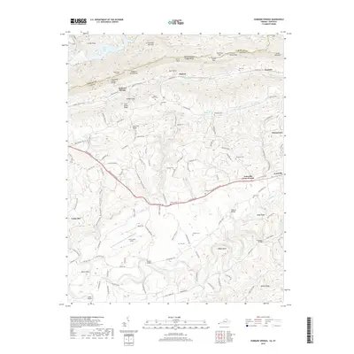
2019 Map of Hubbard Springs
USGS Topo · Published 2019About this map
Cumberland Mountain forms the formidable northern boundary of this landscape along the Virginia and Kentucky border, where the Tennessee Valley Divide dictates the flow of local waters. The southern portion of the map is defined by the winding course of the Powell River, creating prominent geographical features like Wilder Bend and Tyler Bend. Between these heights and the river valley, the area around Jonesville exhibits a traditional Appalachian settlement pattern, with small communities such as Hubbard Springs and Ocoonita linked by historical routes like the Daniel Boone Trl. Local heritage is preserved in numerous family and community sites, including the Jonesville Camp Ground, Bethel Church Cem, and the notable Natural Bridge formation. Modern infrastructure, represented by the Lee County Airport, shares the terrain with older landmarks like the Wagonroad Tunnel, illustrating the area's continuous adaptation to its challenging topography.
Find a feature on this map
123 named features on this map. Tap any name to fly to it.
Don’t see what you’re looking for? This feature index may not catch every label — zoom into the map to look around manually.
Map Details
Editions of this 2019 Hubbard Springs Map
This is the sole edition of this map. No revisions or reprints were ever made.
Other maps of this area

1887 · Jonesville
USGS Topo · 1:125,000

1891 · Jonesville
USGS Topo · 1:125,000

1903 · Harlan
USGS Topo · 1:48,000

1916 · Harlan
USGS Topo · 1:48,000

1916 · Nolansburg
USGS Topo · 1:48,000

1919 · Nolansburg
USGS Topo · 1:62,500

1919 · Harlan
USGS Topo · 1:62,500

1932 · Hagan
USGS Topo · 1:62,500

1935 · Kyles Ford
USGS Topo · 1:24,000

1935 · Hubbard Springs
USGS Topo · 1:24,000