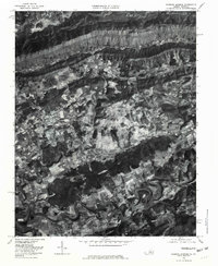
1976 Map of Hubbard Springs
USGS Topo · Published 1981About this map
Cumberland Mountain dominates the northern horizon of this Lee County landscape, casting a long shadow over the scattered homesteads and small communities of the mid-1970s. The terrain transitions from the steep, forested slopes of the ridge down into a valley defined by the meandering Powell River. Along the arterial roads, smaller settlements like Hubbard Springs, Hockett, and Fleenortown are situated near vital water sources such as Sugar Run and Dry Creek. The agricultural patterns visible in the valley reveal a network of small farms and clearings that follow the river's edge and the gentle rise of Cedar Hill. A distinctive topographic feature, Natural Bridge, sits tucked within the hills south of the main river valley, while the presence of Beech Spring underscores the importance of natural water points for early settlement in this Appalachian corridor.
Find a feature on this map
15 named features on this map. Tap any name to fly to it.
Don’t see what you’re looking for? This feature index may not catch every label — zoom into the map to look around manually.
Map Details
Editions of this 1976 Hubbard Springs Map
This is the sole edition of this map. No revisions or reprints were ever made.
Other maps of this area

1887 · Jonesville
USGS Topo · 1:125,000

1891 · Jonesville
USGS Topo · 1:125,000

1903 · Harlan
USGS Topo · 1:48,000

1916 · Harlan
USGS Topo · 1:48,000

1916 · Nolansburg
USGS Topo · 1:48,000

1919 · Nolansburg
USGS Topo · 1:62,500

1919 · Harlan
USGS Topo · 1:62,500

1932 · Hagan
USGS Topo · 1:62,500

1935 · Kyles Ford
USGS Topo · 1:24,000

1935 · Hubbard Springs
USGS Topo · 1:24,000