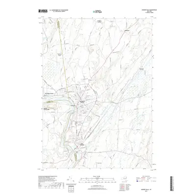
2019 Map of Hudson Falls
USGS Topo · Published 2019About this map
Hudson Falls and Fort Edward define the industrial and civic core of this landscape along the Hudson River, where historical canal systems intersect with modern development. The map details the intricate path of the Glens Falls Feeder Canal and the Old Champlain Canal, illustrating the enduring importance of these waterways to the region's transport history. In the center of Hudson Falls, the Washington County Courthouse stands as a primary landmark, while the surrounding residential blocks lead out toward several significant burial grounds including Union Cem and Moss Street Cem. Further south, Rogers Island sits at a strategic bend in the river near South Glens Falls. The presence of the Floyd Bennett Memorial Airport to the northwest and Papp Airpark to the southeast shows the evolution of transit from the towpaths of the Feeder Canal Heritage Trail to modern aviation.
Find a feature on this map
56 named features on this map. Tap any name to fly to it.
Don’t see what you’re looking for? This feature index may not catch every label — zoom into the map to look around manually.
Map Details
Editions of this 2019 Hudson Falls Map
This is the sole edition of this map. No revisions or reprints were ever made.
Other maps of this area

1893 · Fort Ann
USGS Topo · 1:62,500

1895 · Cambridge
USGS Topo · 1:62,500

1895 · Fort Ann
USGS Topo · 1:62,500

1895 · Glens Falls
USGS Topo · 1:62,500

1897 · Glens Falls
USGS Topo · 1:62,500

1898 · Cambridge
USGS Topo · 1:62,500

1898 · Fort Ann
USGS Topo · 1:62,500

1900 · Schuylerville
USGS Topo · 1:62,500

1901 · Fort Ann
USGS Topo · 1:62,500

1901 · Cambridge
USGS Topo · 1:62,500