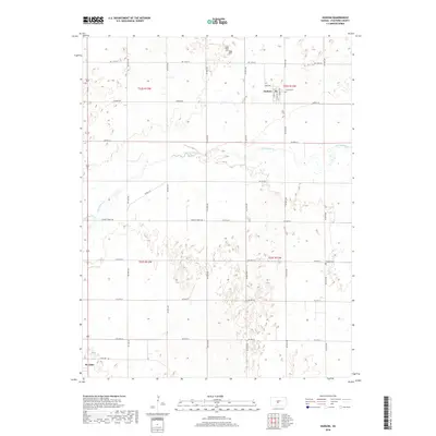
2018 Map of Hudson
USGS Topo · Published 2018About this map
Hudson stands as the primary settlement in this Stafford County landscape, situated where the local grid meets the winding course of Rattlesnake Cr. The town layout is clearly defined by local thoroughfares such as Main St, Church St, and Park Ave, with the Trinity Cem located just on the northern outskirts. This area of central Kansas shows a heavily managed agricultural pattern, with a dense network of section-line roads like NE 90th St and Hudson Rd dividing the terrain.
Find a feature on this map
24 named features on this map. Tap any name to fly to it.
Don’t see what you’re looking for? This feature index may not catch every label — zoom into the map to look around manually.
Map Details
Editions of this 2018 Hudson Map
This is the sole edition of this map. No revisions or reprints were ever made.
Other maps of this area

1891 · Great Bend
USGS Topo · 1:125,000

1892 · Pratt
USGS Topo · 1:125,000

1893 · Great Bend
USGS Topo · 1:125,000

1894 · Pratt
USGS Topo · 1:125,000

1955 · Great Bend
USGS Topo · 1:250,000

1955 · Pratt
USGS Topo · 1:250,000

1957 · Great Bend
USGS Topo · 1:250,000

1958 · Great Bend
USGS Topo · 1:250,000

1959 · Pratt
USGS Topo · 1:250,000
1970 · Hudson NW
USGS Topo · 1:24,000