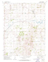
1971 Map of Hudson
USGS Topo · Published 1972About this map
The town of Hudson serves as the central hub for this rural Kansas landscape, situated along the Missouri Pacific railroad line in the early 1970s. The terrain is defined by the winding course of Rattlesnake Creek, which meanders across the quadrangle between the townships of South Seward and West Cooper. This survey captures the region during a period of active energy extraction, evidenced by numerous Oil Wells scattered across the plains of Hayes and St John. Local landmarks like New Hope Ch reflect the community's established social infrastructure, while industrial features such as the Sewage Disposal plant near Hudson indicate the modernizing municipal services of the era.
Find a feature on this map
10 named features on this map. Tap any name to fly to it.
Don’t see what you’re looking for? This feature index may not catch every label — zoom into the map to look around manually.
Map Details
Editions of this 1971 Hudson Map
This is the sole edition of this map. No revisions or reprints were ever made.
Other maps of this area

1891 · Great Bend
USGS Topo · 1:125,000

1892 · Pratt
USGS Topo · 1:125,000

1893 · Great Bend
USGS Topo · 1:125,000

1894 · Pratt
USGS Topo · 1:125,000

1955 · Great Bend
USGS Topo · 1:250,000

1955 · Pratt
USGS Topo · 1:250,000

1957 · Great Bend
USGS Topo · 1:250,000

1958 · Great Bend
USGS Topo · 1:250,000

1959 · Pratt
USGS Topo · 1:250,000
1970 · Hudson NW
USGS Topo · 1:24,000